Water (either salt or fresh) is found in large bodies everywhere throughout Paradise City. Gameplay-wise, the player cannot interact with water in Burnout Paradise and is generally inaccessible. However some lakes, ponds, and even sections of River can be fallen into by slow or careless drivers. In that case the screen blacks out, the car is instantly spawned back on dry land at a safe distance from water. In Stunt Run events, players who are unfortunate enough to fall into water will end their stunt combo as coming into contact with water counts as a wreck.
Here are enumerated all the geographical watercourses in Paradise City.
Ocean[]
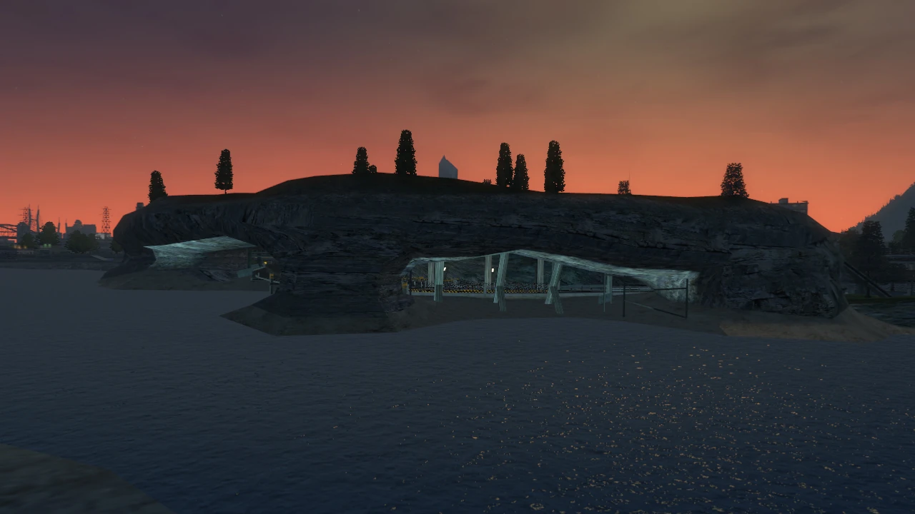
The Cove has 2 openings on its cliff-face.
The largest body of water that can be found around Paradise City. It surrounds the mainland from North-East to South-West. The area covered by the ocean seems infinite, as no land formations such as cliffs or hills can be seen in the distance.
Structures[]
All the structures and landmarks that are built by, or are related to the Ocean.
- Big Surf (Beach)
- The beach and pedestrian area to the west are located on the coast along East Crawford Drive. The area is a key location for several Freeburn Challenges, and it is and ideal area for Stunt Run as well as serving the purpose of a shortcut or parallel itinerary for Race and Marked Man events. Other landmarks include a cave shortcut between East Crawford Drive and Newton Drive, Big Surf forum, and the Big Surf Pier/Ferris Wheel.
- The actual Coastguard building with which the lighthouse is incorporated (in opposition to the under construction HQ along Patterson Avenue), the lighthouse is 1 of 2 present in Paradise City. The HQ is located behind the Angus Wharf warehouses and can be approached thanks to the longer shortcut passing through the industrial area. The HQ's location is marked by the lighthouse, which is noticeable from afar.
- Motor City Docks
- The Docks area includes the whole industrial sector from Watt Street to the Coastguard HQ. There are several warehouses located in this area, one of which is accessible to the player and acts as a shortcut. Other shortcuts pass north of Angus Wharf through this zone. This industrial area also features a loading yard in where shipping containers are stacked. Several loading and building cranes are present here. Two Billboards and several Smash Gates can be found in this area.
- Paradise Ferry
- This somewhat large building is the ferry terminal which Paradise City inhabitants can use to access oversea locations as well as Big Surf Island. The building cannot be approached, nor can the 3 docked ships. There are no shortcuts around the building and globally no interactions with this structure can be made.
- Angus Wharf Bridge
- This short green metal bridge passes over a canal which itself leads to an open area with two piers and a few storage warehouses. The road becomes metal grilling over the canal.
- See full article for details.
- This large cable-stayed bridge was added with the Big Surf Island update and links Big Surf Island to the mainland.
- Waterfront Marina
- The Marina stretches from (behind) the Symbol of the City to the Rayfield Grand Hotel. The Marina currently holds no less than 15 prestigious yachts of various sizes. It is possible that the section of the Marina found directly behind the hotel is owned by this building. The boats cannot be approached by the player.
- Several "Waterfront Regatta" banners can be found in the northern part of the marina. "Regatta" is a word used to describe a boat race, thus the "Waterfront Regatta" banners are actually promotional for the boat race which takes place at the Waterfront instead of being thought as markers for the Marina's location.
- Paradise Wharf
- The industrial area in this district (Harbor Town) includes several well-known locations by players:
- The Wharf Warehouses serve as a very useful (and safe) shortcut and is sometimes the meeting point for Freeburn Challenges.
- The Paradise City Seafood Wholesalers building, noticeable from far away thanks to the enormous swordfish statue placed on the building's roof.
- Griffin's Fish Sales is another shortcut-filled building with access to a billboard.
- The Paradise Wharf sub-district also includes several piers; Players will also find a Super Jump in this area.
- South Bay
- Driving along the South Bay Expressway reveals many industrial structures, fuel silos and most notable, the Fort Lawrence Naval Yard in which 2 military grade aircraft carriers are docked. One ship's inside hangar, but the flight deck cannot be reached.
- West of the military ships are 2 cargo ships, one of which is docked (and being loaded) by 2 very large cranes. Players cannot access the vessel, but they can use a shortcut that passes between shipping container stacks. This path leads to several Billboards and a Super Jump.
- See full article for details.
- The South Bay Expressway Bridge is one of the (few) large suspension bridges that can be found Paradise City. This bridge reaches over the body of water that stretches as far as the Rockridge Dam.
Silver Lake[]
The lake itself is named after the district to the North-East of this watercourse. This massive body of water (921.6 acres!) is the largest lake in Paradise City, making it the main semi-natural landmark of the rural part of the city. It is circled by East Lake Drive, West Lake Drive, Chubb Lane and Geldard Drive. There is a small river supplying the Lake with water from the mountains to the North-West while Rockridge Dam is located south. The presence of the Dam indicates that this lake is not natural and thus artificial. If it existed before the dam's construction, it is likely that it would have been much smaller in size since the ocean lies beyond it making the creation of a natural lake improbable and even impossible.
Silver Lake is also named after the track in Burnout 3 which also featured a road going around a very large lake and a small town.
Structures[]
- Rockridge Dam and Dam Waterworks
- See full article for details.
- This gigantic structure is located at the south of the lake; Geldard Drive passes over it and Casey Pass passes south of it. The "Waterworks" is an industrial facility built at the bottom of the cliff, north of the Dam, and it is accessible from the Dam itself or by a ramp from West Lake Drive.
- Angus Boat Rental
- This lakeside marina features several piers and a crane to lift ships in and out of the water. Many boats can be found in this area. Additionally, sightseers will notice the lakeside residence to the South of the marina. Further north lies a dirt path stretching under the over-passing East Lake Drive, over a shipwreck and finally leading to a Super Jump ramp.
- Silver Lake Island
- Though not exactly a structure, several small estates are actually built on the island. The island is accessible thanks to a Super Jump at the end of a pier which is accessible from East Lake Drive by an off-road shortcut. Silver Lake Island essentially features personal homes (some of which are under construction). Players can leave the island by using the jump found to the north of the of the grounds. This jump also leads to a Billboard and back onto East Lake Drive. Several motorboats and yachts are docked along (and near) the island.
- Silver Lake Island is also a location featured in several Freeburn Challenges.
- Silver Lake Marina
- The "official" marina that features several piers and boats as well as a sandy beach complete with beach huts. It can be accessed by wooden path opening on the south side of East Lake Drive. This path can also be used as a shortcut and a good venue for Stunt Run events as there are 2 Billboards along this route.
- Lakeside Residences
- Beyond Chubb Lane are several houses built along the shore. A camping site featuring mobile homes is located next to Sunset Valley's Gas 5 station on Chubb Lane. Several other homes can be spotted along this road, all of which are linked to the main road via an inaccessible driveway. Parked vehicles can be seen on the other side of these driveway gates but cannot be interacted with, even during Showtime.
Gallery[]
")
White Mountain River[]
This smaller River is the waterway that supplies Silver Lake with fresh water from the highlands of White Mountain and Crystal Summit.
It is sensible to emit the hypothesis that White Mountain River was once a much longer waterway stretching out south and flowed directly into the Ocean, but is now cut off by Rockridge Dam (and thus the recently created Silver Lake). Supposing this were the case, then South Bay would be the remains of this River's old estuary. The White Mountain River would also have been much longer than the Paradise City River.
Layout[]
The current river's layout is broken up into 3 distinct sections, each ended by a waterfall or mouth preceding a considerable change in size compared to the previous section.
Sources[]
The White Mountain River is first visible between the two cliff faces forming the river's gorge (named Dead Man's Edge). It is most likely that the visible stream seen in this location is the emergence of a subterranean river network considering the small size of the stream. The waterway continues south-east and passes under the Crystal Summit Yellow Bridge after which it chutes down and forms the first waterfall.
Main Section[]
After the first waterfall, the course falls into a pool located a few yards north of Nelson Way and continues south-east by passing under this road. At this point the River is of respectable size. South-East of Nelson Way, a river bifurcation occurs; A small arm stretches east while the main stream channel continues straight on to another waterfall. The parallel distributary actually leads to The Sunset Watermill, and as it's name suggests is a watermill built along the River's smaller stream (see structures). This secondary channel continues on until it reaches the same cliff and forms another waterfall alongside the main stream's waterfall.
Mouth[]
Both courses join back in a large plunge pool made by the combined chute of both waterfalls found north-west of West Lake Drive. From then on the River is separated again, thus surrounding the White Mountain River Island. Both arms of the River then flow into Silver Lake at the River's current mouth.
Structures[]
- See full article for details.
- This dangerous cliff can be jumped from North Mountain Drive and counts as a Super Jump. A small diner restaurant is located on the north "Edge."
- See full article for details.
- The Crystal Summit Railroad passes here and the River flows under the steel bridge. The bridge features a Billboard and a Super Jump ramp that can be taken from the derelict bridge south of it.
- See full article for details.
- The main road in the rural area of Paradise City passes over the River at the Chubb Lane intersection. A Billboard can be smashed via a broken wooden bridge located North of the junction.
- The Sunset Watermill
- As its name rightfully suggests, this watermill is built along the secondary arm of the River (before the final waterfall) in the Paradise Woods area. The mill and its rotating wheel are visible from the improvised dirt car park along Chubb Lane. The building itself cannot be approached.
- Sunset Island
- Marking the mouth of the River to the north-west of Silver Lake lies a small island over which passes West Lake Drive (thanks to 2 steel Truss bridges).
- A large Hotel-like building (most likely an old Balneotherapy Center) is built on this island, but it seems abandoned since fences at its entrance bear warning signs and entry restrictions. This may be due to the fact that the cliff face has become unstable or the building itself is dilapidated. The building cannot be directly approached, but a small path can be taken to come as close as the aforementioned fences.
- The access path leads players to a broken bridge (south-west of the abandoned structure) where can be executed a Super Jump.
Paradise City River[]
Paradise City River is the natural river flowing through the urban part of Paradise City. It takes its source in the Heartbreak Hills geographical region, somewhere between Lawrence Road and West Crawford Drive but strangely gets narrower as it approaches the Ocean as in reality the River's span gets wider. The River is crossed by several roads but can never be completely jumped over, except on 1st Street.
Layout[]
Sources[]
The earliest waterway feature is a large waterfall located to the south-west of (and visible from) the I-88 Toll Booths between Sections 2 & 3. The stream-sized river continues down, under the I-88 and through a woodland area, before reappearing west of Newton Drive. Another waterfall can be seen here as the stream crashes down. The watercourse flows under the road and forms a first small pond (which can be jumped over). The flow carries on from the pond until Lambert Parkway, to the east at which point it goes completely underground, flowing under the road and the West Big Surf Railroad. It reemerges east of the tracks and curves slightly south-east before passing under Hamilton Avenue Bridge.
Main Section[]
After this road, Paradise City River gains its largest span, since the banks have been artificially widened to serve as an industrial area where boats can be docked and loaded. The River flows east under the Paradise Bridge and then curves South parallel to Glancey Avenue. The watercourse curves back West nearing the 4th Street junction and follows this road, the river will have passed the Twin Bridges and Young Avenue Bridge. While heading West, the river is crossed by Root Avenue, Paradise Avenue (once more) and Franke Avenue. Once passed the Franke Avenue Bridge, the flow turns and aligns itself with Evans Boulevard to head South; 3rd Street, 2nd Street and 1st Street all pass over the river on this section.
Mouth[]
Oddly, as the River approaches the Ocean, its span gets narrower. A "real-life" river would see its width increase as it approaches the coastline. The River reaches the Ocean under the Harber Street Bridge and the I-88 overpass which are incidentally the shortest bridges over the Paradise City River.
Bridges[]
No less than 12 bridges cross the Paradise City River. Most are simple straight Beam/Truss Bridges but others are different, such as the Hamilton Avenue Bridge or the Paradise Bridge. The 1st Street Bridge is the only incomplete bridge.
- Hamilton Avenue Bridge
- This is the first "actual" bridge that crosses the River. It is very different from the other bridges as it is the only one which features a slope as well as the only cable-stayed bridge over the River. To some, Hamilton Avenue Bridge is considered the most aesthetic structure over the Paradise City River. The bridge has a single span and is painted white, the support tower where all cables are attached is located to the north and a second attached to the main leans back to act as a counter-weight.
- Paradise Avenue Bridge
- The second bridge following the course of the River. It is special in a sense since it is the only Bascule Bridge over the River. Gameplay-wise, it is notable that the bridge is partially lifted and acts as a Super Jump Ramp. The bridge has a single span and is painted red.
- Twin Bridges
- The best known bridges over the River. They are dual Truss bridges sharing the central beam. They carry both 7th Street traffic flows over the River. A stone tower is located at either end of each beam. The bridges are made of steel and also are colored green.
- Young Avenue Bridge
- Young Avenue crosses the River thanks to another Truss bridge supported by pillars in the River and not supported at the banks. This bridge also carries the El-Train Tracks. The bridge is composed of steel beams painted white.
- Root Avenue Bridge
- Root Avenue crosses the River by a double span Truss bridge. Inexperienced players are advised to take care and as there are central separators at both ends of the bridge. Drivers are also advised to take the Bridge in oncoming traffic as this will build up the boost. The bridge is made out of riveted red steel beams.
- Paradise Avenue Bridge
- The second time Paradise Avenue crosses the River (following it's course). This bridge in opposition to the Paradise Bridge is also a single span truss bridge but is not movable. This is the only single span bridge that links Downtown Paradise to Palm Bay Heights. It is painted the same hue of red as the previous bridge and is also composed of steel beams. This bridge is also partly covered.
- Franke Avenue Bridge
- Even if this bridge is of the same type as the previous mentioned, the structure looks remarkably different, primarily because of its white paint and also because of its cross-like shaped beams which form the Truss structure. Franke Avenue is split into two distinct traffic lanes over this bridge and the separator can be a hazard beginners may want to avoid. This is also one of the longest bridges over the Paradise City River.
- Covered River Bridge
- Where 3rd Street passes over the River. It is inaptly named "Covered" due to the fact that road users traveling west on 3rd Street will not see the River itself when approaching the Bridge because of the large building that stretches over the road and prevents drivers from seeing beyond it. The Bridge itself is not covered, it is a dual span Truss bridge composed of steel girders that are colored gray.
- 2nd Street Bridge
- A bridge very different from all previous bridges found along the Paradise City River. This is a stone and steel Truss bridge but where the walls and towers are decorated with classical friezes (that can be also found on the Paradise City City Hall). The bricks that are used to build the towers are white and give this bridge a very classical looking appearance.
- 1st Street Bridge
- The only partially built bridge over the River since it is still undergoing construction, the El-Train will also pass over the River here. Once completed, the bridge will most probably be a double-decker steel Truss bridge with the top level carrying the tracks. At either end of the bridge are Super Jump ramps and to the right is a Split Ramp enabling drivers to do a Barrel Roll.
- Harber Street Bridge
- The shortest bridge to cross the River and also the farthest one down its course. It is another Truss bridge painted green where the riveted I-Beams are arched above the deck. The bridge features only a single span.
- Note: In reality this isn't a Truss bridge per se, the straight road simply passes horizontally over the River and the section above the water is supported by the a steel Truss structure.
- I-88 Overpass
- The highway itself being naturally elevated above the road shows no particular bridge features to pass over the narrow River. The Westbound on-ramp however, passes over the narrow span thanks to a short green Truss bridge.
North Lake[]
Also ironically known as "Crystal Summit Lake", this natural lake located in Hillside Pass, a sub-district of Silver Lake, (found between North Rouse Drive and Nelson Way) is the second largest natural lake in Paradise City. The Crystal Summit Railroad's North Lake Suspension Bridge passes over this natural body of water creating a very scenic view admirable from any location. The lake itself cannot be approached and cannot be fallen into either, making its purpose in-game purely decorative.
The natural Lake must be supplied by an underground river network or be formed out of rainfall water as there are no rivers or streams linking it to other watercourses such as Silver Lake.
Seeing the remoteness of the area and all parameters taken into account, it is understandable that there are no structures built on the shores of the Lake, and none to be found in the vicinity, the closest being located on Nelson Way.
Heartbreak Hills Lake[]
The Heartbreak Hills Lake is the third smallest lake in Silver Lake. It is located along Nelson Way and Rack Way and is it cut off to the east and south by a woodland area. The lake's primary purpose seems to be linked with the water treatment facility: the Heartbreak Hills Water Treatment Center of which the buildings are built along the roads. The lake isn't accessible to the player because of the walls built around the facility.
No rivers flow into or from this watercourse, it is believed that the Lake is still linked to its larger counterpart Silver Lake via a subterranean river network, which is a plausible outcome since the smaller lake is on higher ground than the larger making it possible for the water to travel underground.
Sunset Valley Pond[]
The small town of Sunset Valley, appropriately named Sunset Valley Town, features a small pond located in the town center between Chubb Lane and West Lake Drive.
The pond is speculated to be a lake, but it is very hard to determine this and even harder to examine because of the fences put up around the park area south of the Stadiums (see structures). The "satellite" map of Paradise City shows the pond clearly, but players at street level will not notice the watercourse, let alone see it while speeding down Chubb Lane.
Structures[]
This pond being located at the heart of a countryside town is adjacent to many buildings, most notable of which are the Sunset Valley Town Hall, and the Sunset Valley Stadium. However directly next to the pond are two hut-like sheds and a concrete embankment.
Lone Peaks Stream[]
The Lone Peaks Stream is a very small stream that is generally waterless in the moment the game is set. The stream starts out at the side of a cliff near the intersection of South Mountain Drive, North Mountain Drive, and Hans Way. It has no visible water flowing in it; however, the way that the ground has been cut exposing white rock makes it certain that water has eroded the path. The rocky stream path descends until it passes under Lucas Way and finally stops at a small water-filled pond, proving indeed that it is a stream. It is possible that the stream continues on past the pond into an underground network of rivers. It is also possible that it is somehow connected to the Lone Peaks Quarry Stream. Going through Tindle's Mind which is located in front of the visible ending of the stream, there is no sign of the river. This could mean two things: The stream ended at the pond or the stream descended even deeper and that makes it more likely that it runs into the Quarry Stream. The underground river would have to basically curve southwest, but the Quarry Stream is slanted in that direction. At close glance, the overhead map shortly shows water that is located past the pond as there is a split in the middle, but where the river continues is not known. Oddly enough, if the player falls into the stream a water splashing sound effect will be played.
Origins[]
1.) - Run Off
It is most likely that the stream is formed by runoff from the surrounding mountains during heavy rainfall. At the moment in the game, the visible start of the strem is dry all the way until it stops at a waterfilled pond which most likely means that during heavy rainfall water comes down the stream and collects in this pond . So, this is the most likely origin.
2.) - Mountain Stream
This option is less unlikely but possible. It is possible that the stream is part of a stream that goes further on past the mountains and the section is dry at the moment but there is no way of knowing because the beginning is not visible.
Lone Peaks Quarry Stream[]
The Lone Peaks Quarry Stream is a long stretch of fresh water that is found at the bottom of the quarry.
Origins[]
Why water can be found in the Quarry is can not be 100% determined, but several valid hypotheses are possible:
1) - A semi-Natural cause:
- This stretch of water may be a very short section of what could be an underground river network. The underground river may have been accidentally daylighted due to the mining activity undergone in the quarry.
2) - Fully Artificial cause:
- The water reserve may have been created artificially by the mining corporation since some mining techniques use water in their system. This hypothesis is the least likely.
3) - Indirect Natural cause:
- The mining operations carried out in the quarry having ended it is possible that a bit was dug at the very bottom of the quarry and rainwater may have slowly filled the pit.
Structures[]
The quarry's buildings are the only structures adjacent to this waterway, many ramps are located next to the water to allow drivers and stuntmen engaged in Stunt Run events to achieve a long jump or a Barrel Roll. Unfortunately to some, no fences are set up along the river's banks making this watercourse somewhat dangerous for slower players that would be unable to make the jump over it, this is very important to note in Stunt Run as a dip in the water will end the stunt combo.
Downtown Park Pond[]
The Downtown Park Pond is the smallest pond in Paradise City. It is part of a small park located in Downtown Paradise.
It was certainly created artificially along with the Park itself, however, it is possible that the Lake was originally there when Paradise City was built although this is highly unlikely.
Players cannot approach the lake, and thus cannot fall into it. The lake is visible from the overpass pedestrian bridge but globally, the lake is largely "hidden" by hedges and fences.